- The 20 Best Hiking Spots in Malawi
- 1. Mount Mulanje (Mulanje)
- 2. Nyika Plateau (Rumphi)
- 3. Zomba Plateau (Zomba)
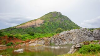
- 4. Senga Hills (Senga Bay, Salima)
- 5. Viphya Plateau (Mzimba)
- 6. Dzalanyama Forest Reserve (Lilongwe)
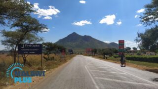
- 7. Dedza Mountain (Dedza)
- 8. Ntchisi Forest Reserve (Ntchisi)
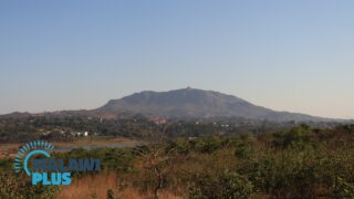
- 9. Nkhoma Mountain (Lilongwe)
- 10. Bunda Mountain (Lilongwe)
- 11. Misuku Hills (Chitipa)
- 12. Blue Zebra Island (Lake Malawi)
- 13. Mumbo Island (Lake Malawi)
- 14. Michiru Mountain (Blantyre)
- 15. Mount Soche (Blantyre)
- 16. Ndirande Mountain (Blantyre)
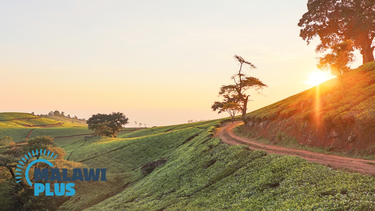
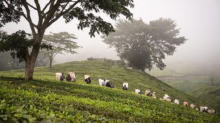
- 17. Satemwa Tea Estate (Thyolo)
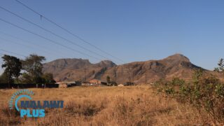
- 18. Chombe Plateau (Rumphi)
- 19. Ngala Hill (Lilongwe)
- 20. Kasungu Hill (Kasungu)
The 20 Best Hiking Spots in Malawi
Malawi is an idyllic country for hiking and trekking and has one of the most exceptional landscapes in Africa.
Lake Malawi occupies a quarter of the country and its lowest point is almost at sea level, while Malawi’s highest peak, Mount Mulanje, reaches 3,002 metres.
This variety of elevation in a small country means that there is a breathtaking variety of lush trails throughout Malawi, including plateaus, highlands, forests, mountains, plains, sheer cliffs and dramatic river valleys.
Mount Mulanje is made up of hard metamorphic rocks such as granite and diorite and has the longest rock-climbing trails in Africa.
It may look like a precipitous, rugged mountain, but once you step onto the mountain, you will find lush grasslands and forested plateaus.
Many hikers refer to it as ‘Island in the Sky’ because of its majestic appearance as it looms surrounded by clouds soaring towards the sky.
Other prominent hiking and trekking destinations are also included in this booklet such as Nyika in the North, Dedza and Dzalanyama in the Central region and Zomba in the South.
This article also contains some hidden hiking and trekking destinations known only to locals that can be appreciated on a day trip.
1. Mount Mulanje (Mulanje)
– Highest Mountain in Malawi –
Hiking Difficulty Scale:
Estimated Hiking Time: 3 Hours to 3 Days (depending on route)
Height: 3,002m
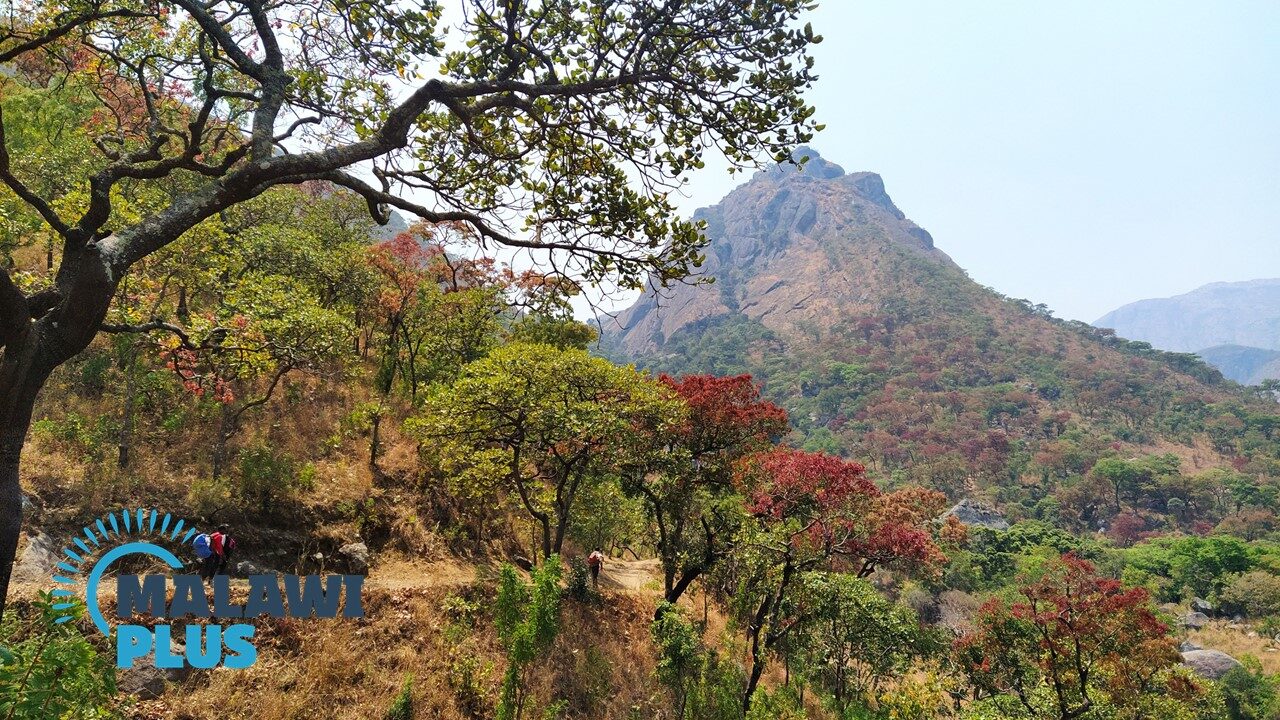
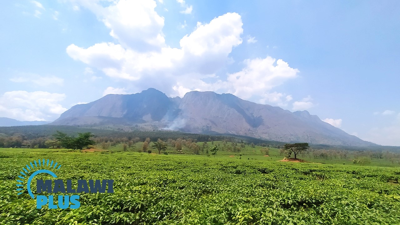
Mount Mulanje which is Malawi’s highest mountain (3,002 m) is located 65 km east of Blantyre and is locally known as “chilumba mu mlengalenga” (‘Island in the sky’).
This is because on misty days the mountain is shrouded in a smoky haze and the peak of the mountain breaks through the clouds.
The Mulanje massif is composed of hard metamorphic rocks such as granite and greenstone, which were formed by magma eruptions about 130 million years ago, eroding the surrounding soft rocks and gradually exposing them.
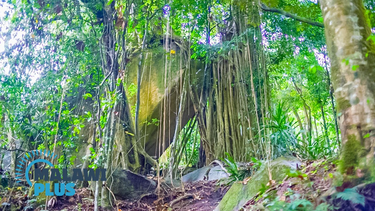
To the west of the mountain lies Chambe Peak, Africa’s longest rock-climbing spot, and although the climb may seem precipitous and rugged, once you step onto the mountain you are surrounded by valleys and ridges with grasslands, wooded plateaus and forested valleys that offer remarkable green vistas.
Mount Mulanje has 6 major trailheads and 10 mountain lodges, with more than 20 peaks above 2,500 m scattered throughout the area.
Hiking routes can be set up in a variety of ways, but it is best to decide according to your interests and the number of days you can spend in the mountains.
You can take a walk through the green tea plantations at the foot of the mountain or embark on a day hike to the spectacular Likhubula falls or attempt to climb Malawi’s highest peak, Sapitwa, while staying in a clean and simple mountain lodge.
This is guaranteed to be an unforgettable adventure.
Guides and porters can be arranged on the day of the hike at the various trailheads at the foot of the mountain.
Although guides and porters are not mandatory, it is recommended that you hike with a guide because it can be difficult to find your way in unfamiliar terrain and the weather can change abruptly.
2. Nyika Plateau (Rumphi)
– Walk amongst Wildlife –
Hiking Difficulty Scale:
Estimated Hiking Time: 1 to 5 Days (depending on route)
Height: 2,605m
Located in northern Malawi, Nyika National Park covers an area of 3,200km2 and is the largest national park in Malawi.
It is also Malawi’s oldest national park, having been established in 1965.
Almost the entire Nyika Plateau, which rises over 2,500m above sea level, is designated as a national park, and the landscape of rolling hills, grasslands and flowers is breathtakingly stunning, leaving visitors speechless.
The name Nyika means “Where the water comes from”, since the plateau is Malawi’s most important catchment area.
It is also home to the richest orchid population in south-central Africa, with more than 200 species in bloom during the rainy season. Eleven of these species are endemic to Nyika, and a further 27 are found nowhere else in Malawi.
Nearly 100 species of mammal have been recorded in Nyika National Park, including large herds of antelope and the largest population of leopard in Central Africa.
You can also see eland, roan, zebra, buffalo and elephant.
Moreover, night drives also offer the possibility of encountering hyenas and other small nocturnal predators.
Nyika is also one of Malawi’s leading birding destinations, with over 400 bird species and four species found in Nyika that have not been recorded elsewhere in Malawi (Yellow Mountain Warbler, Chirring Cisticola, Ayres Cisticola and Mountain Marsh Widow).
The best way to appreciate the majestic scenery of Nyika is by taking a three-day hike to Livingstonia.
Mountain bikes can also be hired at the lodge.
3. Zomba Plateau (Zomba)
– Experience the Most Spectacular Spots –
Hiking Difficulty Scale:
Estimated Hiking Time: 1 to 8 Hours (depending on route)
Height: 2,087m
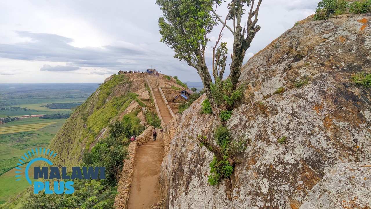
The Zomba Plateau extends behind Zomba Town, which was also Malawi’s first capital until 1974, when the first president moved the capital to Lilongwe.
The plateau is a huge mountain of about 130 km², with its highest point, Malombe Peak, reaching 2,087 meters above sea level.
It is perfect for hiking, and the view of Zomba from the top of the mountain is so remarkable that it came to be known as “the best in the British Empire” during the colonial period.
Giant butterflies and baboons can also be seen on the plateau.
Many hikers use the Sunbird Ku Chawe Hotel as a starting point for their hikes, and the Zomba Plateau offers a wide range of beautiful scenery, including Malombe Peak, Chingwe’s Hole, William’s Falls and many more.
There are various locations where you may take in the beautiful and breathtaking vistas.
The Zomba Plateau is located approximately 80 km north of Blantyre and offers a variety of hiking trails ranging from 1- 8 hours in duration, making it possible to have a day trip from Blantyre.
Additionally, Zomba also offers excellent accommodation, restaurants, and British colonial architecture such as the Governor General’s residence and the Old Parliament buildings.
We strongly encourage you to spend the night in the area because there are so many historical sites to explore.
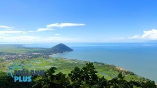
4. Senga Hills (Senga Bay, Salima)
– Magnificent View of Lake Malawi from the Top –
Hiking Difficulty Scale:
Estimated Hiking Time: 1.5 to 5 Hours (depending on route)
Height: 500-600m
Senga Hills is located on the lakeshore of Senga Bay, Salima District, approximately 120 km east of Lilongwe.
It is within the Senga Hills Forest Reserve and is estimated to be 500-600 meters above sea level.
It consists of seven hills, all of which offer spectacular views of Lake Malawi and the town of Salima.
Malawi has many attractive mountains and hills for hiking, but not many places offer a panoramic view of Lake Malawi from the top of a mountain like the Senga Hills.
This article introduces the most popular trail that takes about 5 hours to hike to the top of all seven hills including the highest point in the Senga Hills.
If you are short on time or not confident about your stamina, a 90-minute round trip to the top of the first hill will also be a great experience.
The starting point is just before the entrance to the Sunbird Livingstonia Hotel, turn left.
Some of the hills are a bit steep, but if you wear good hiking shoes and are in good physical condition, you should have no problem.
However, Senga Bay is very sunny and gets very hot during the day, so be sure to bring plenty of water and wear a hat to protect heat stroke.
It is also recommended to start hiking early in the morning, when it is cooler.
First-time hikers should always take a guide, as it can be difficult to find the route.
Guides can easily be found at the lodge in Senga Bay or by asking at the Sunset Souvenir Market on the way to Senga Bay from Lilongwe.
Senga Bay is popular as the closest beach resort from Lilongwe, but it is also nice to see the lake from the top of the mountain once in a while.
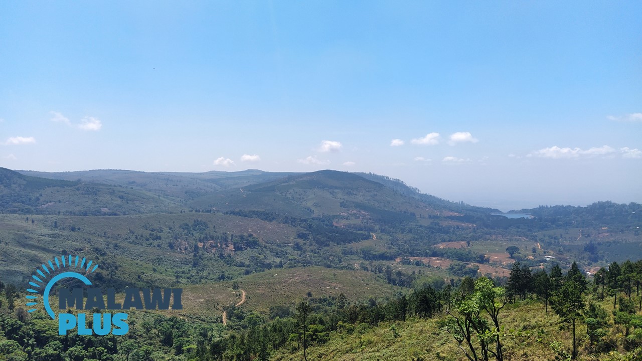
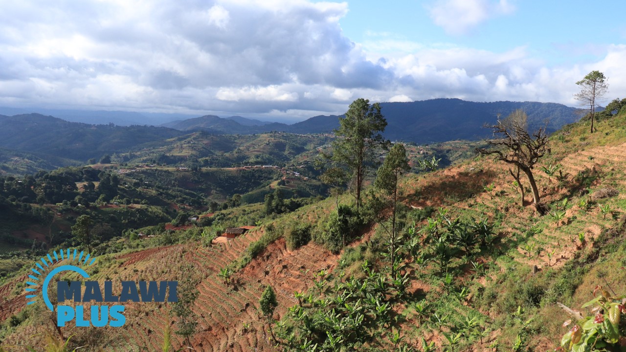
5. Viphya Plateau (Mzimba)
– Discover the Largest Man-made Forest in Africa –
Hiking Difficulty Scale:
Estimated Hiking Time: 3 Hours to 3 Days (depending on route)
Height: 2,050m
Located at an altitude of 1,700 m in northern Malawi, the Viphya Plateau is home to the Viphya Forest, which covers an area of 560 km² and is considered the largest planted forest in Africa.
It is an exciting highland wilderness with several beautiful rivers flowing into Lake Malawi, mixed with montane grasslands, evergreen forests and exotic pine species, and a spectacular scenic landscape.
There are many excellent hiking trails, especially around the Luwawa Forest Lodge, with marked paths and safe walks through the forest.
Walking through the plantations of sweet-smelling pine trees, you can feel a sense of peace and tranquillity.
The area is also ideal for birdwatching, with more than 280 wonderful bird species to observe.
The most popular walk is the three-day walk, which begins at Kawandama Hills, passes through the Viphya Forest wilderness, descends the steep slopes of the Rift Valley and finishes near the Kande Beach Resort on the shores of Lake Malawi.
For all hikers who love outdoor activities, this is a dream come true in Malawi.
It is also perhaps the best area for mountain biking in the country.
The Luwawa International Mountain Bike Marathon has been held every June since the first edition in 2004.
The race starts at Kasito Lodge and finishes at Luwawa Forest Lodge, 53 km away.
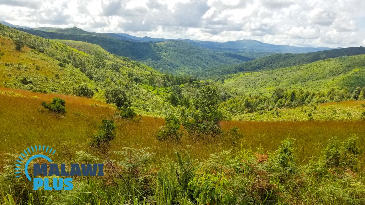
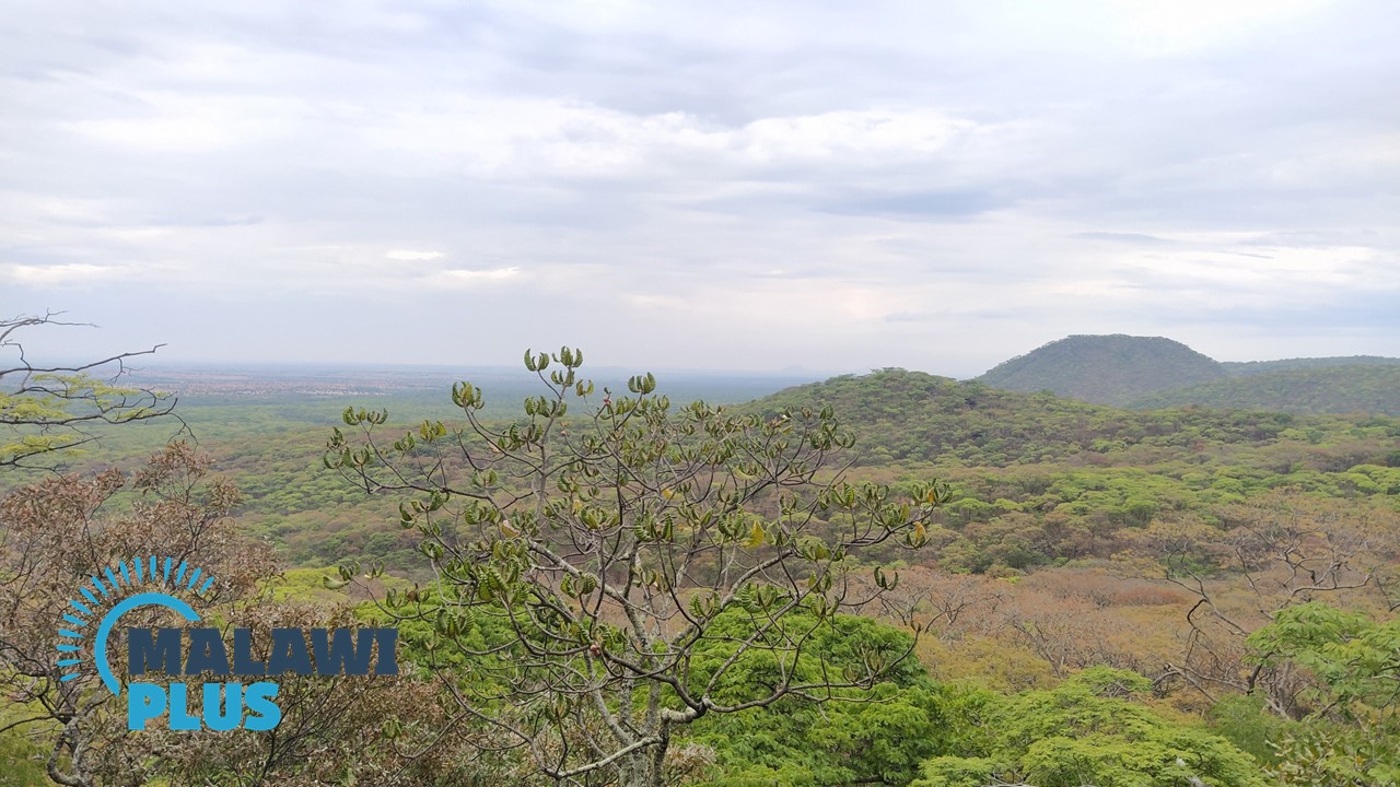
6. Dzalanyama Forest Reserve (Lilongwe)
– Hiking with More Than 300 Bird Species –
Hiking Difficulty Scale:
Estimated Hiking Time: 3 Hours
Height: 1,650m
Dzalanyama Forest Reserve which lies 60 km south-west of Lilongwe, is a popular hiking destination for local and international tourists.
Dzalanyama means ‘place of animals’ in the native Chichewa language and is registered as a forest reserve to protect Lilongwe’s water resources.
The reserve covers an area of 989 km2 and is between 1100 m and 1650 m above sea level, making the hilly forests of Brachystegia and Miombo the best places for walking, trekking, mountain biking and forest bathing.
It is also home to more than 300 bird species and bird guides are provided by the local community.
There are 7 trekking trails that start from Dzalanyama Forest Lodge.
Although the trails vary in length and difficulty, they are well signposted, and everyone can enjoy them, from easy walks to thrilling hikes.
You can even make a day trip from Lilongwe or stay at Dzalanyama Forest Lodge for the weekend and enjoy nature at its best.
The Lodge also has a camping site with barbecue facilities.
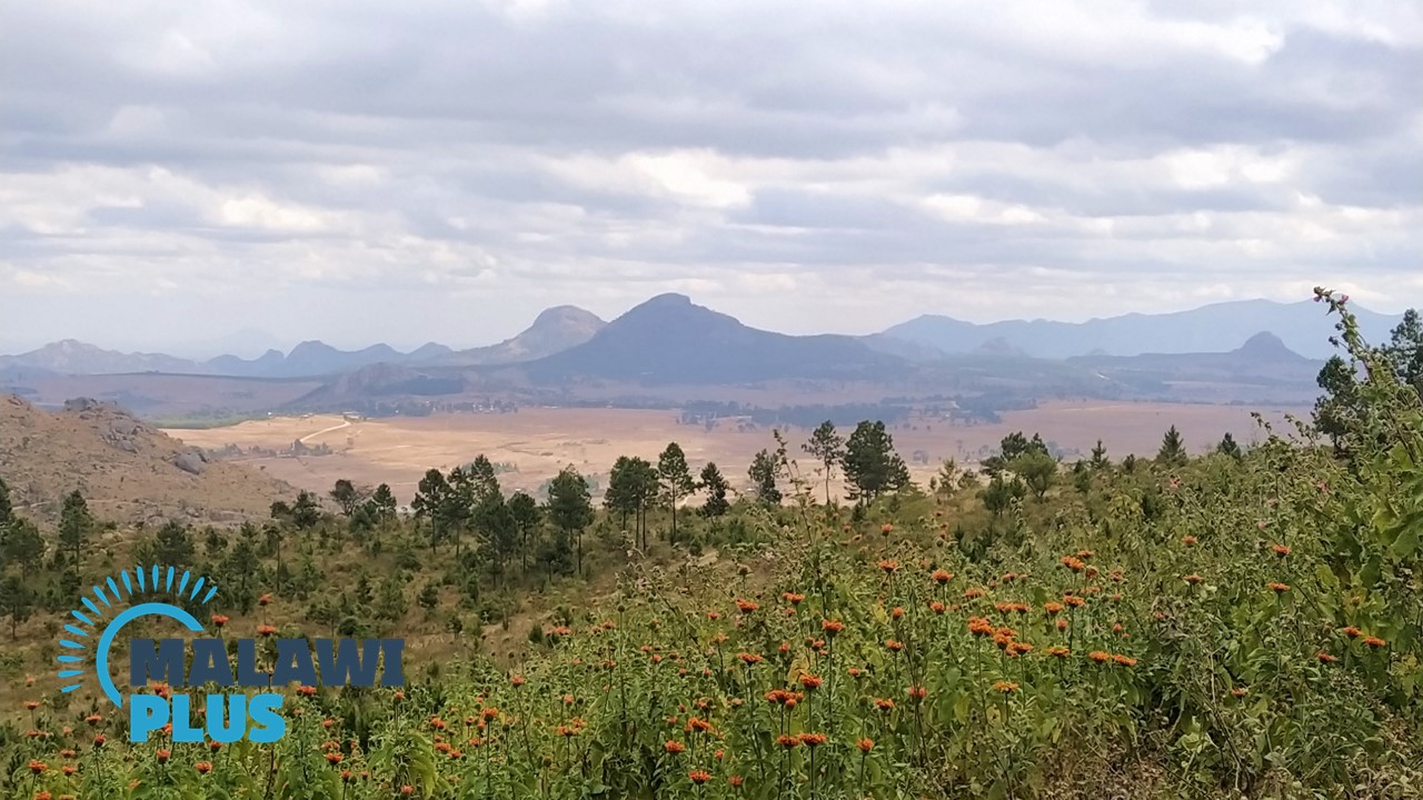
7. Dedza Mountain (Dedza)
– Enjoy 23km Walk Where Wildflowers and Butterflies Welcome You –
Hiking Difficulty Scale:
Estimated Hiking Time: 5-7 Hours
Height: 2,198m
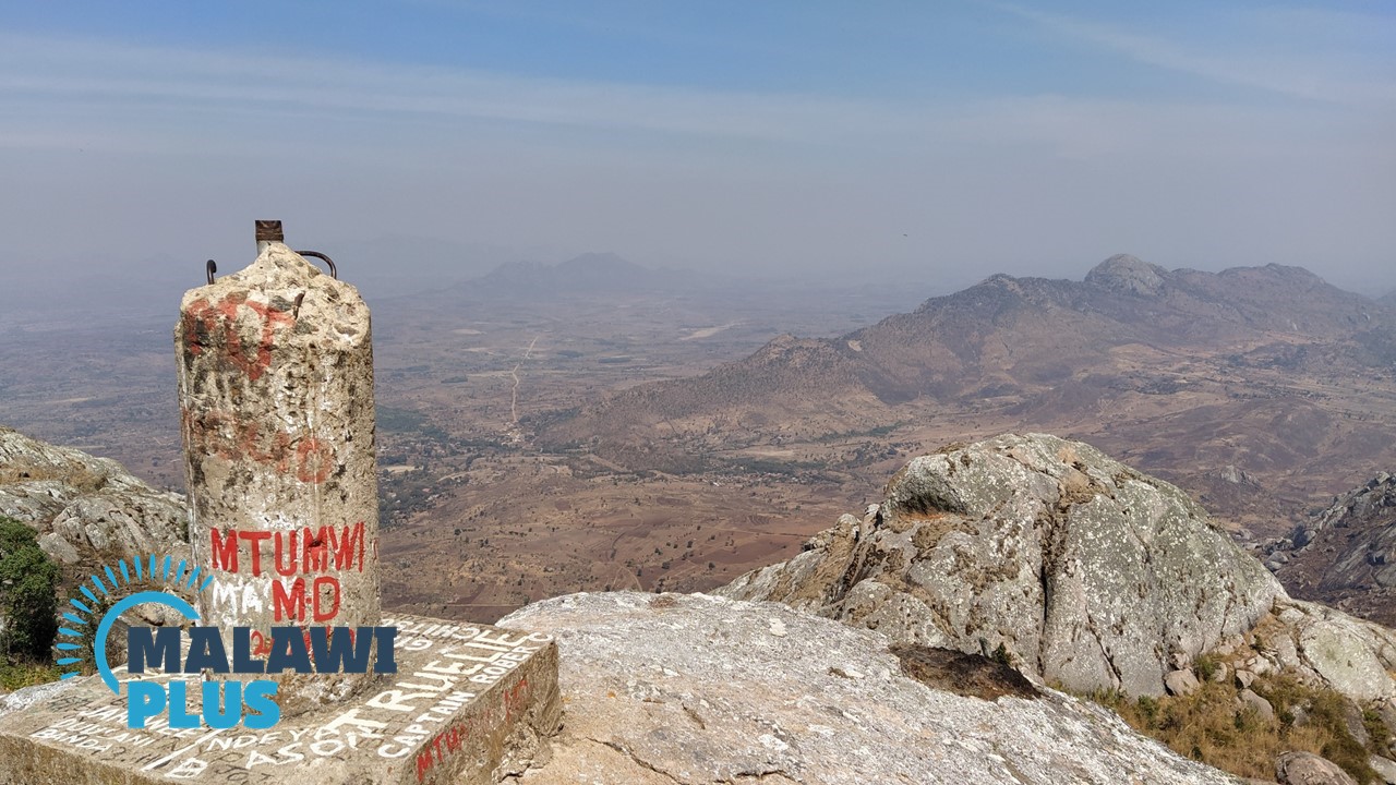
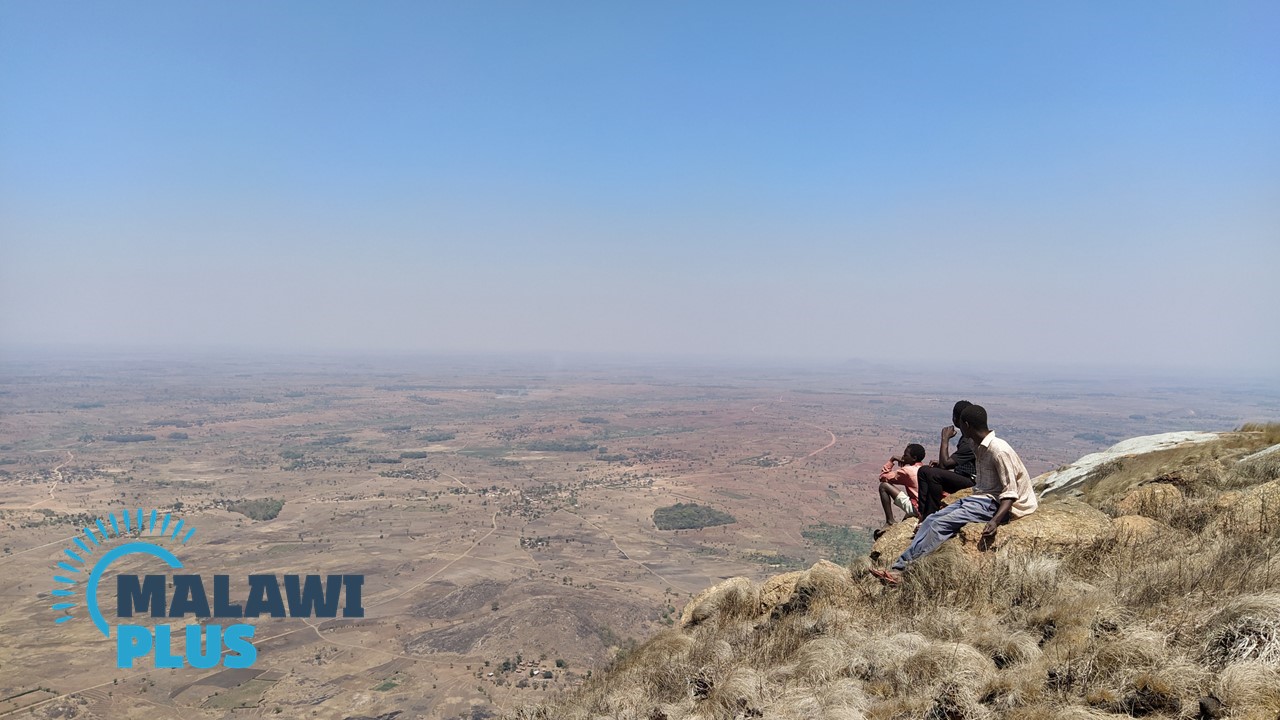
Dedza Mountain is a 2,198 m high mountain in Dedza District, Central Malawi lying 90 km southeast of Lilongwe on the M1 Road.
Covering an area of 2,917 ha, the Dedza Forest reserve was established in 1926.
The mountain is mostly covered in planted pine trees, which give it a pleasant aroma.
On your way to the top, you will be welcomed by a variety of wildflowers along the path and there are usually many butterflies fluttering around.
On a clear day, the hike offers spectacular views in all directions.
To the east, Lake Malawi and Mozambique, and to the south, the outstanding views of the Zomba Plateau and Mount Mulanje.
The most popular hike on the Dedza Mountain is a 23 km round trip dirt route starting from Dedza Pottery Lodge, which sells Malawi’s favorite souvenirs.
The hike is not very steep, but it is a long walk, so if you are not confident about your fitness, we recommend an alternative route.
After descending, enjoy cheesecake and coffee at Dedza Pottery or browse the pottery shop.
You could also spend the night in Dedza and spend the next day at the UNESCO World Heritage Site, Chongoni Rock Art Area to see traditional rock paintings, or at the KuNgoni Centre to enjoy Malawian culture and traditional carvings.
8. Ntchisi Forest Reserve (Ntchisi)
– Malawi’s Last Remaining Tropical Rainforest –
Hiking Difficulty Scale:
Estimated Hiking Time: 3 Hours
Height: 1,702m
Located at an altitude of 1500-1700m, and covering an area of approximately 75 km2, Ntchisi Forest Reserve is one of Malawi’s last remaining intact rainforests, located about 90 km north-east of Lilongwe.
The climate at Ntchisi Forest Reserve is cooler than in the surrounding lowlands, making it suitable for sheltering from the summer heat.
In the mountain lowlands, visitors can walk through a variety of vegetation, including pines, Brachystegia and Heliconia towering 30 metres overhead, and giant figs, vines and ferns in the rainforest.
The flora of this rainforest is of outstanding natural beauty and a true highlight of the area.
There are several walking options within the reserve.
Three colour-coded trails – red, blue and yellow – are available, and are all well marked, with trees and rocks regularly painted in their respective colours.
Ntchisi Forest Lodge which is located within the reserve, has been developed in recent years to cater for international visitors and is rapidly gaining a reputation for itself.
The hiking trails can be enjoyed as a day trip from Lilongwe, but after hiking, a late lunch at the lodge or an overnight stay for a delicious course dinner is also a superb option.
9. Nkhoma Mountain (Lilongwe)
– Most Rewarding Mountain to Climb around Lilongwe –
Hiking Difficulty Scale:
Estimated Hiking Time: 4 Hours
Height: 1,800m
Nkhoma Mountain rises behind Nkhoma Mission Hospital, about 60 km south of Lilongwe on the M1 road, and can be seen from the centre of Lilongwe.
Nkhoma Synod was founded in 1889 by Scottish missionaries from South Africa, and Nkhoma subsequently became the Mission’s headquarters.
The area around Nkhoma Mission is a lovely, green, tranquil place with historic buildings.
Nkhoma mountain has two peaks, Nkhoma and Mbalambala, locally known as ‘the-two-headed mountain’.
It is very popular with local hikers as the most challenging and rewarding of the mountains around Lilongwe.
From the top of the mountain, you can see Lilongwe, Lake Malawi and other distant landscapes.
The spectacular views will leave you awestruck.
The first part of the hike is not signposted, so ask a local to guide you.
After the first 4 km, a gentle gradient with colourful wildflowers, a hut is erected.
The next 2 km to the summit are more rocky and more challenging, but even beginners can make it to the top.
10. Bunda Mountain (Lilongwe)
– Malawi Version of the Great Wall –
Hiking Difficulty Scale:
Estimated Hiking Time: 2 Hours
Height: 1,159m
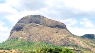
Bunda Mountain is a small mountain which is 1,159m high, rising on a flat plain 20km south of Lilongwe, near Bunda College of Agriculture.
Bunda Mountain’s hiking trail is ideal for beginners and the unique decorations on the summit as well as the remarkable views from the top mak it a very popular destination for locals and tourists.
The summit is usualy crowded with locals offering their prayers and some describe the stone-walled path also known as the ‘Moses Highway’, as Malawi’s version of the Great Wall of China.
Flom the top, visitors can appreciate 360-degree panoramic views of Nkhoma Mountain, the sorests of the Bunda College grounds, the Kamuzu Dam and Lilongwe Township.
It is a short two-hour round trip, making it ideal for a half-day trip from Lilongwe.
11. Misuku Hills (Chitipa)
– Walk through Mzuzu Coffee Plantations –
Hiking Difficulty Scale:
Estimated Hiking Time: 3 Hours
Height: 2,050m
Located in the Chitipa District, about 300 km from Mzuzu City in northern Malawi, the Misuku Hills comprise the Mughese Forest Reserve (1,600-1,880 m) and the Wilindi-Matipa Forest Reserve (1,700-2,050 m).
To the north, the Songwe River flows through the area, which borders Tanzania.
The hills are home to more than 100 endemic bird species and 150 tree species, and the internationally recognized Misuku Hills are also known for Mzuzu Coffee and Misuku Honey.
A leisurely hike through lush coffee and banana plantations is recommended as you take in the culture which is unlike any other in Malawi.
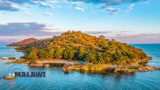
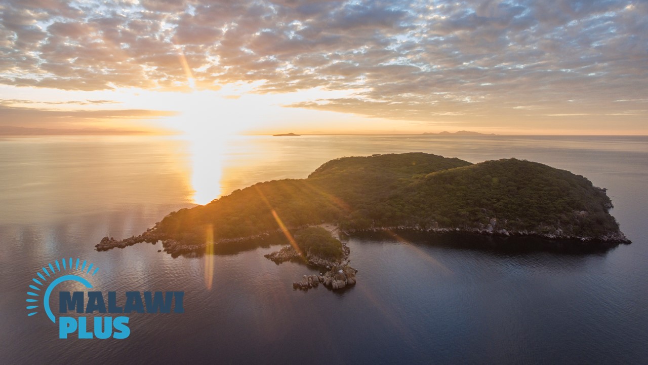
12. Blue Zebra Island (Lake Malawi)
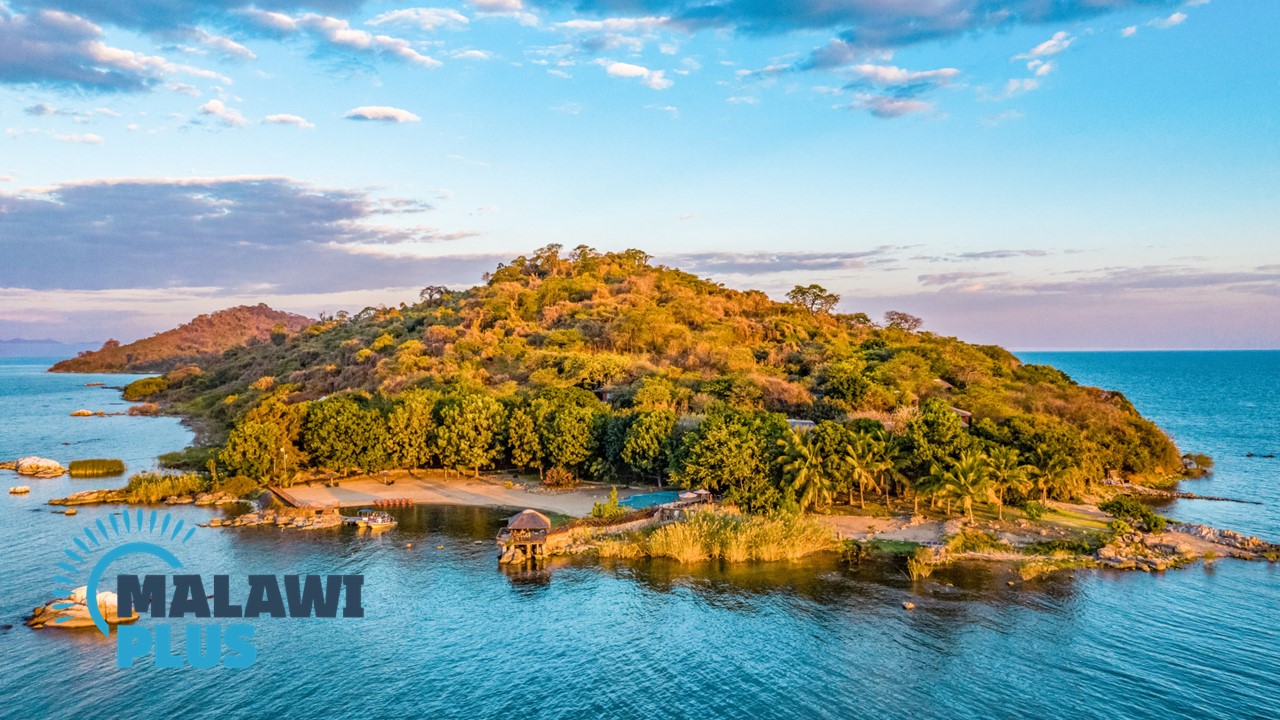
– Explore a Remote and Beautiful Island Paradise –
Hiking Difficulty Scale:
Estimated Hiking Time: 1 Hour
A remote and beautiful island paradise, Blue Zebra Island Lodge is located on Nankoma Island in the Marelli Archipelago, under the protection of Lake Malawi National Park, a UNESCO World Heritage Site.
The island is 23 km from Salima and 29 km from Cape Maclear, a 20-minute boat ride across the lake.
It is known for its large number of vibrant freshwater fish and is popular for water activities such as snorkelling, diving, cruises and kayaking, but it is also a birdwatcher’s paradise, with rare and exotic birds to be found.
A 2.3 km nature trail circles the island, passing through old fig trees and giant baobab trees.
The walk is leisurely, but a steep slope leads up to the summit, where a breathtaking panoramic view awaits after the ascent.
At dawn, duikers and bushbuck may be seen. Other animals that you can see include turtles, chameleons, lizards, rainbow skinks and many bird species.
Blue Zebra Island Lodge is an ideal destination for nature enthusiasts that are seeking a blend of adventure and relaxation in a quiet, private setting.
13. Mumbo Island (Lake Malawi)
– Explore UNESCO World Heritage Site –
Hiking Difficulty Scale:
Estimated Hiking Time: 1 Hour
Mumbo Island is a pristine tropical island located within Lake Malawi National Park, 10km northwest of Cape Maclear.
Surrounded by crystal clear freshwater, this uninhabited island is only 1km in diameter and offers a variety of water sports including swimming, kayaking, snorkelling and scuba diving.
Mumbo Island also has five carefully constructed nature trails that wind their way between the huge granite rocks that make up the island.
The striking forests that criss-cross the island are rich and spectacular, with trees such as baobab, fig, ficus, sterculia, kaya, albizia and brachystegia.
There are no poisonous snakes or dangerous animals on Mumbo Island and the trails are clearly signposted, so you can trek without a guide.
After a day of hiking and plenty of activities, you can swing in a private hammock on the tent deck, enjoy tea time in the comfortable lounge, sip a good glass of wine while watching the sunset, or just relax as you please, away from the hustle and bustle of the city.
14. Michiru Mountain (Blantyre)
– Explore the Closest Nature Reserve from Blantyre –
Hiking Difficulty Scale:
Estimated Hiking Time: 3 Hours
Height: 1,470m
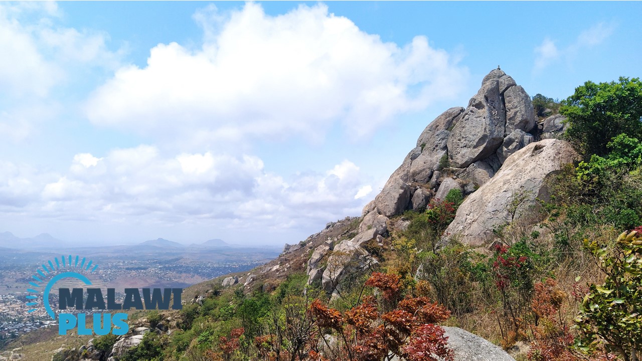
At 1,460 m above sea level, Michiru Mountain is the closest nature reserve to Blantyre, located 8 km north-west of Blantyre Township, and is the only mountain around Blantyre that still contains primary forest and some wildlife.
Michiru Mountain is an ideal day hike or picnic from the Blantyre area and is popular with families and local young people, as well as international tourists.
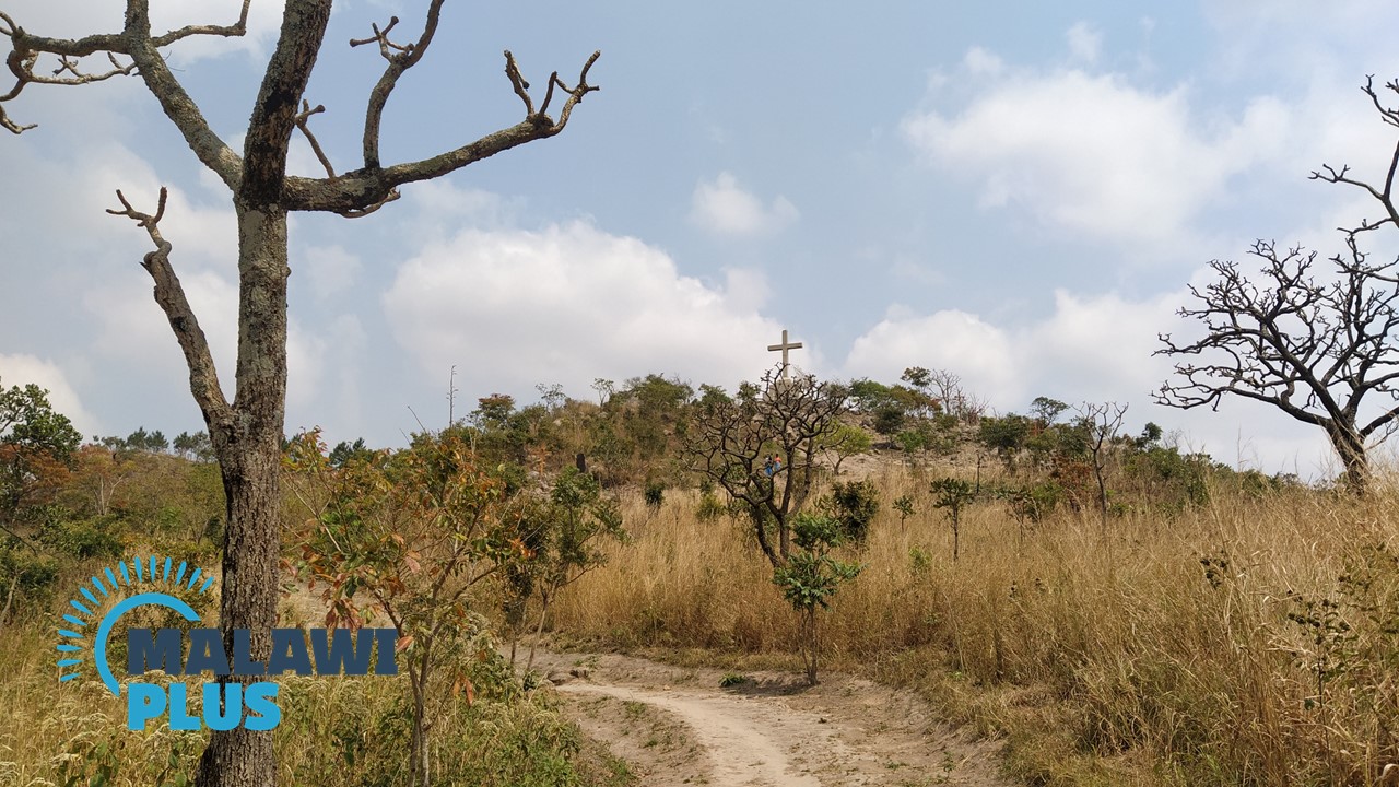
There are several hiking routes, the most popular being the ‘Way of the Cross/Njira ya Mtanda‘.
There are 15 points leading up to the main cross at the top, depicting the events of Jesus’ journey to Golgotha.
You don’t have to be a Christian to enjoy the well-maintained path and atmosphere.
You can also take in the view of Blantyre while having a snack at a picnic table near the cross.
If you have time and energy to spare, try to reach the summit of Michiru Mountain.
The hike to the top takes about three hours, but the panoramic view from there is spectacular.
15. Mount Soche (Blantyre)
– 360° Panoramic View in the Heart of Blantyre –
Hiking Difficulty Scale:
Estimated Hiking Time: 4 Hours
Height: 1,530m
At 1530 metres, Mount Soche is the closest mountain to Blantyre Township and it offers spectacular views of Blantyre from its summit.
The trail is well marked and the green-painted rocks make it easy to find your way to the top.
It is a great place for a half-day hike around Blantyre, but there is also a camp site near the summit where you can pitch your tent, camp and enjoy the sunrise from the summit the next morning.
The mountain has a unique atmosphere that is a little different from other mountains in Malawi, with many locals offering their prayers and some religious slogans painted all over the mountain.
Mount Soche is a great mountain to visit when you want to exercise and refresh yourself in Blantyre.
16. Ndirande Mountain (Blantyre)

– Conquer One of the Most Popular Mountains in Blantyre –
Hiking Difficulty Scale:
Estimated Hiking Time: 4 Hours
Height: 1,609m
At an altitude of 1,609m, Ndirande Mountain is one of the most popular mountains with local hikers around Blantyre, along with Michiru Mountain and Mount Soche.
The mountain can be reached after passing the bustling Ndirande Market, where you can find everything from second-hand clothes, coffins, fruit and vegetables to car parts and furniture made by local artisans.
There are several hiking options on the mountain, but the most popular are a leisurely walk along a 4×4 track to the cell tower known as the Kamuzu Lookout on the south side of the range, or to the top of Ndirande Mountain.
There are some steep gradients near the summit and some areas where you have to use your hands, but it is not too difficult.
On a clear day, from the top you can see the town of Blantyre, the surrounding mountains, the Zomba plateau and the direction of Mulanje.
This is a good mountain for those who want to do a day climb from the Blantyre area with family or friends during the weekend.
17. Satemwa Tea Estate (Thyolo)
– Walk through Tea and Coffee Estates –
Hiking Difficulty Scale:
Estimated Hiking Time: 3 Hours
Height: 1,462m
Located in Malawi’s southern Thyolo district, Satemwa Tea Estate was established in 1923 and is one of Malawi’s oldest tea and coffee estates.
It has been producing excellent tea and coffee for almost 100 years and exports it all over the world.
With more than 170km of dirt roads and hundreds of paths and tracks, Satemwa is the perfect place for those seeking an unusual and special hike.
Take a leisurely stroll along the banks of the creek while enjoying a guided walk through the coffee fields or you can climb the rocky slopes of Thyolo Mountain for magnificent views of Mount Mulanje and the Lower Shire Valley.
In the evening, Thyolo’s magnificent tea plantations are coloured golden by the sunset.
This spectacular view is a must-see for sunset lovers.
The site also provides an ideal habitat for Malawi’s many species of birds, including the endangered Thyolo Alethe (Alethe choloensis).
After a hike at Satemwa Tea Estate, relax with a cup of tea or coffee and soak up the calm and tranquility.
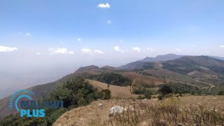
18. Chombe Plateau (Rumphi)
– Malawi’s Most Spectacular View from the Summit –
Hiking Difficulty Scale:
Estimated Hiking Time: 6 Hours
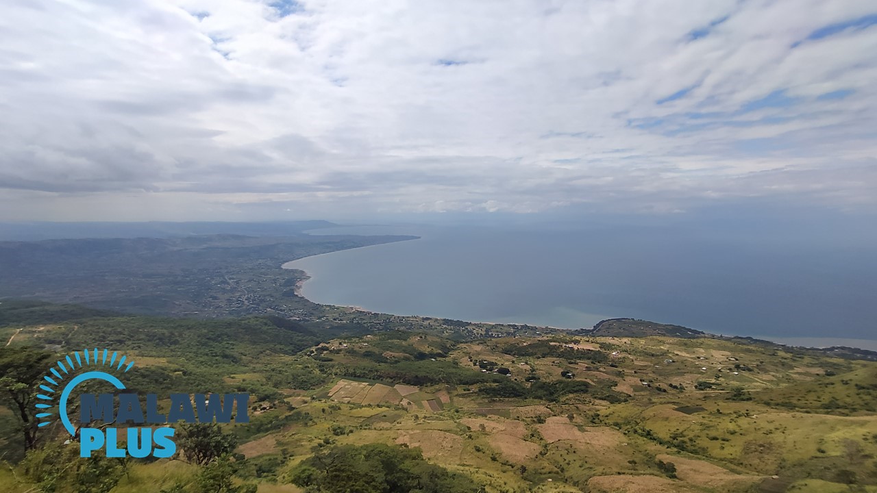
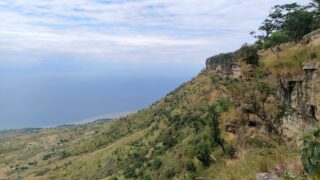
Located in Livingstonia, Rumphi District, the Chombe Plateau is still not well known, but from the top of the plateau, the view of Lake Malawi and the surrounding mountains of Tanzania and Mozambique is spectacular and will make you forget the long way up.
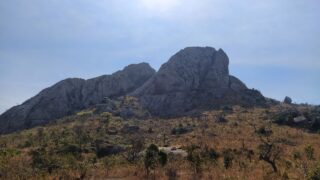
19. Ngala Hill (Lilongwe)
– Mountain that Looks as if it is Smiling –
Hiking Difficulty Scale:
Estimated Hiking Time: 2-3 Hours
Height: 1,560m
Ngala Hill is a mountain in Lilongwe, estimated to be 1,560 metres high.
It is a steep 4km climb to the top of Ngala Hill and you will need to use all your limbs to get to the top.
The hill is visible from the M1 and is known for its crevasses, which look like smiling mouths.
20. Kasungu Hill (Kasungu)
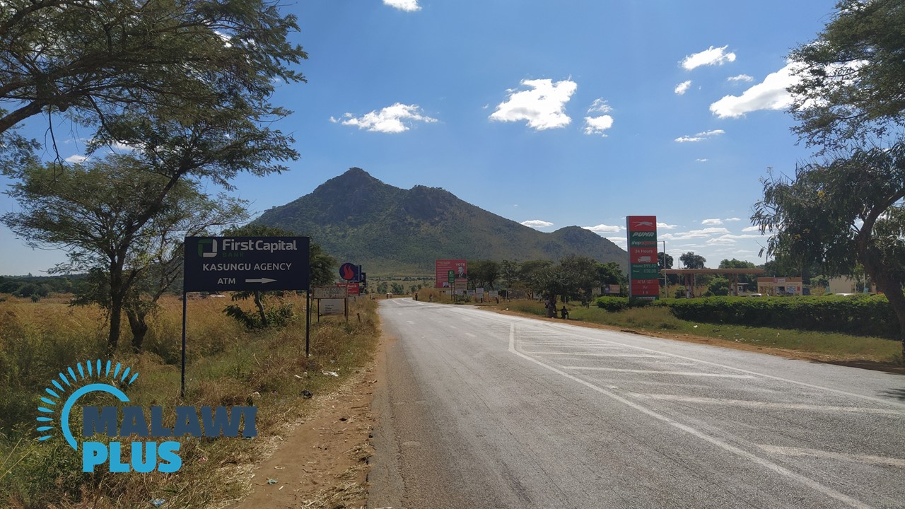
– Mountain Rising in front of the M1 Road –
Hiking Difficulty Scale:
Estimated Hiking Time: 2 Hours
Lilongwe has several worthwhile hiking spots including Bunda Mountain, Nkhoma mountain and Ngala mountain.
If you have climbed all of them and are looking for your next mountain to climb around Lilongwe, Kasungu Hill is the place for you.
From the summit you can enjoy a panoramic view of Kasungu.